
The BeiDou Navigation Satellite System (BDS) has recently undergone a significant upgrade to meet the increasing demand for high-precision positioning across various sectors. The new services introduced aim to provide decimeter-level accuracy within minutes, which marks a substantial improvement over the existing capabilities.
With the rapid advancement of technologies such as autonomous driving, robotic navigation, and smart city infrastructures, there is a surging demand for highly accurate and reliable positioning systems. While traditional systems like GPS, GLONASS, and Galileo have set high standards, challenges such as limited regional coverage and long convergence times still persist, emphasizing the need for enhanced navigation satellite systems.
Researchers from the Beijing Institute of Tracking and Telecommunication Technology, in collaboration with the Shanghai Astronomical Observatory and Wuhan University, have recently published a study in the journal Satellite Navigation. The study, released on 24 June 2024, delves into the high-precision services of the BeiDou system, outlining its current status, achievements, and future trajectory.
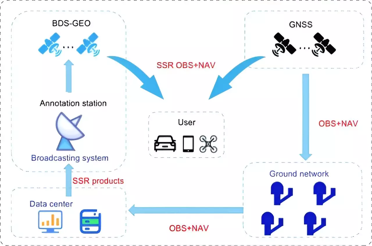
The study focuses on the PPP-B2b of BDS-3, which achieves decimeter-level accuracy within 14 minutes. Despite these advancements, BDS-3 still falls behind international counterparts like Galileo’s HAS and QZSS’s CLAS in terms of regional coverage and convergence time. To address these limitations, the research proposes a multi-layer development framework that emphasizes the integration of low Earth orbit (LEO) satellites.
By incorporating a LEO constellation of 288 satellites, the positioning accuracy can be improved to better than 5 cm within approximately 1 minute, significantly enhancing global coverage and reducing convergence time. Simulation results indicate that LEO-enhanced PPP services can achieve rapid and precise positioning, positioning BeiDou as a frontrunner in high-precision satellite navigation.
Impact on Modern Navigation Applications
Dr. Xingxing Li from Wuhan University highlights the pivotal role of advancements in BeiDou’s high-precision services in meeting the escalating demands of modern navigation applications. The integration of LEO satellites is particularly promising, as it enhances coverage and reduces convergence time, bringing us closer to achieving real-time, centimeter-level positioning accuracy on a global scale.
Implications for Various Applications
The enhanced high-precision services of BeiDou have profound implications for various applications, including autonomous driving, unmanned aerial vehicles, and smart device navigation. This progress signifies a significant advancement in the evolution of global navigation satellite systems, firmly establishing BeiDou as a leader in high-precision services.
The evolution of the BeiDou Navigation Satellite System represents a significant leap into the realm of high-precision positioning, with the integration of LEO satellites paving the way for enhanced accuracy, coverage, and convergence times. These advancements have far-reaching implications for modern navigation applications, positioning BeiDou as a key player in the global navigation landscape.
Leave a Reply